Sonar Sludge Surveying
With our advanced sonar sludge surveying capabilities, we provide precise assessments of sediment accumulation in water bodies and containment areas. By utilizing state-of-the-art sonar technology, we produce detailed maps and volumetric data to support decision-making and optimize dredging and sediment removal operations. Our comprehensive surveys enable clients to identify sediment hotspots, evaluate environmental impacts, and formulate targeted remediation strategies with precision and confidence.
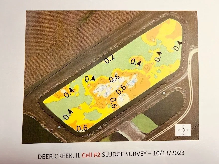
Sonar sludge surveying is a specialized water treatment service employed to assess and map the accumulation of sludge in water bodies such as lagoons, lakes, ponds, and other bodies of water.
Sonar Technology
GPS Integration: The system utilizes GPS to tag each measurement point, creating an accurate map of sludge levels across the water body.
Data Analysis: The collected data is processed to generate 3D maps and reports, highlighting sludge volume and distribution.
Applications
Sludge Management: Facilitates efficient planning for sludge removal or dredging operations.
System Maintenance: Ensures optimal functioning of lagoons by identifying areas with excessive sludge buildup.
Environmental Compliance: Provides data to meet regulatory requirements for sludge monitoring and disposal.
This service is crucial for maintaining the health and efficiency of water and wastewater treatment systems.